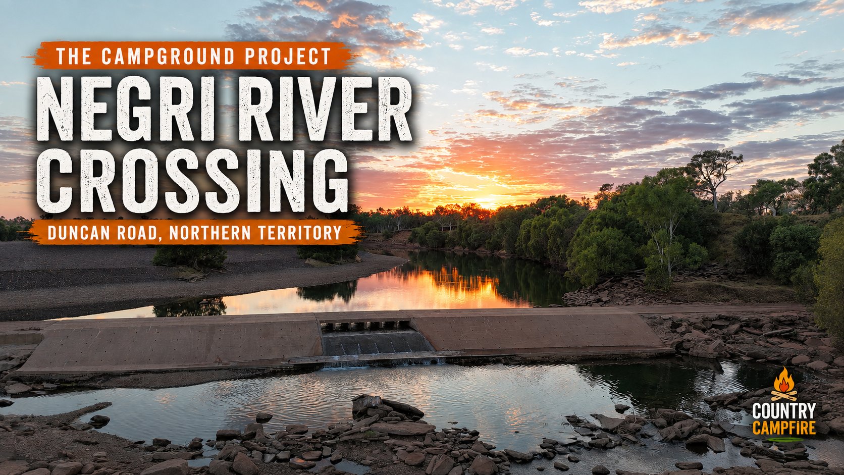
Some camps give you one good reason to stop. Negri River Crossing gives you a choice of them: running water over the causeway, open river-rock camping close to the crossing, shaded sites beneath paperbarks farther downstream, and enough space to settle in without feeling crowded.
Gary and Christine Barten stayed here in August 2026 with their caravan and two dogs while travelling along Duncan Road in the Northern Territory. With the weather warming up, they enjoyed the river setting, caught a couple of Sooty Grunters and found plenty of options for setting up beside the water.

Quick Campfire Notes
- Campground: Negri River Crossing
- Location: Duncan Road, near Buchanan, Northern Territory
- Coordinates: -17.0759064, 129.0029746
- Visited: August 2026
- Cost: Free when visited
- Setup: Caravan
- Travelling with: Couple with two dogs
- Best for: Self-sufficient travellers with a 4WD, caravan or camper
- Facilities: Basic bush camp with no facilities
- Campsites: Open river-rock areas near the crossing and shaded options farther downstream
- Access: Unsealed road with corrugations, washouts, dips and floodways when visited
- Would they stay again? Absolutely
Camping beside the Negri River causeway
The campsites are on the western, downstream side of the crossing. Gary found a large, relatively flat area with plenty of space for caravans and campers.
Gary and Christine chose a spot close to the causeway. They enjoyed hearing the water cascade over the crossing, and the broad open area gave them good sunlight for solar charging and clear sky for their Starlink connection.
The ground around the main camping area was predominantly river rock and generally straightforward to negotiate. Gary did note some patches of fine river pebbles and soft sand that required more careful driving in 4WD.
Open campsites or paperbark shade
One of the strengths of Negri River Crossing is the choice of camping areas.
Travellers wanting easy access to the river, plenty of sunlight for solar and open sky for Starlink can stay nearer the causeway. Those looking for more shade can follow the track farther west along the river, where large paperbark trees provide more protection from the sun.
Gary cautioned that access to the water from the shaded area was steep and difficult, making the open section near the crossing the easier option for reaching the river.
Fishing and crocodile country
Gary and Christine had some success fishing during their stay and landed a couple of good Sooty Grunters.
They also saw plenty of freshwater crocodiles, including some large animals, and Gary photographed several resting among the rocks at the water’s edge.
Gary understood that this section of the Negri River feeds into the Lake Argyle catchment and did not expect saltwater crocodiles at the campsite. Country Campfire has not independently verified the absence of saltwater crocodiles, and visitors should not rely on that assumption.
Although Gary and Christine entered the water during their visit, this article does not present Negri River Crossing as a safe swimming location. The Northern Territory Government’s Be Crocwise guidance says Top End waterways cannot be considered completely safe and advises people not to swim where there is no designated swimming-area sign. Crocodiles were visibly present at this location, so keep people and dogs away from the water’s edge and follow current official advice.
Getting to Negri River Crossing

The northern end of Duncan Road meets the Victoria Highway approximately 14 kilometres from the Western Australia–Northern Territory border.
From the Victoria Highway end, follow Duncan Road south for approximately 133 kilometres to the Negri River. Cross the causeway and turn immediately right to enter the main camping area on the downstream side.
Gary’s supplied route screenshot showed an estimated driving time of a little over two hours from the northern end of Duncan Road. Treat that only as a mapping estimate: actual travel time can vary substantially with corrugations, washouts, floodways and changing road conditions.
Road and vehicle access
Gary recommends a 4WD. During their August 2026 visit, Duncan Road was unsealed with corrugations, wet-season washouts, numerous dips and floodways.
Conditions on remote unsealed roads can change quickly. Check the official NT Road Report before travelling and reassess conditions locally, particularly after rain.
Negri River Crossing coordinates
Campground and crossing pin:
Get directions to Negri River Crossing
Photos from Negri River Crossing

The open river-rock camping area beside the Negri River. 
Sunrise over Negri River Crossing during Gary and Christine Barten’s August 2026 stay. 
The Duncan Road causeway and nearby camping area at Negri River Crossing. 
An aerial view of Gary and Christine’s campsite beside the Negri River crossing. 
Freshwater crocodiles photographed beside the Negri River during Gary and Christine’s stay.
Would They Stay Again?
Absolutely.
Gary and Christine loved the setting and the choice of campsites. The flowing water, fishing, broad open areas and paperbark shade gave them several different ways to enjoy the river camp.
Some people you meet on the road are weird
Gary summed up one moment from their stay simply: “Some people you meet on the road are weird!”
Two caravans arrived and spent some time driving around the large camping area looking for a suitable place to stop. Despite all the available space, the travellers eventually walked over and asked whether they could camp directly beside Gary and Christine.
Gary told them, “Of course, park anywhere you like.” Thankfully, the new neighbours were quiet and moved on the following day—but it was much closer than Gary and Christine would ever choose to camp beside someone else when there was that much room available.
As Gary put it, you meet all kinds of people on the road, from weird to wonderful.

Gary & Christine Barten
Travellers • Campers • Campground Contributors
Gary and Christine Barten are Australian travellers whose love of remote camping, country towns and the road less travelled has helped showcase some of Australia’s hidden campground gems through The Campground Project.
Part of The Campground Project
This campground yarn is part of The Campground Project—Country Campfire’s effort to collect genuine campground stories, photographs and practical notes from people who have actually stayed there.
If you have found a campground worth sharing, you can submit your own campground yarn through The Campground Project form.
A quick note before you travel
Campground access, river levels, road conditions, fire restrictions, fees, dog rules, crocodile activity and campsite availability can change. These notes are based on Gary’s August 2026 visit and are intended as a trip-planning reference only.
Always check current road and weather conditions, official crocodile guidance, local advice, fire restrictions and relevant land-manager information before heading into remote country.