Some camps are memorable because of what is built around them. Others are memorable because there is almost nothing there at all.
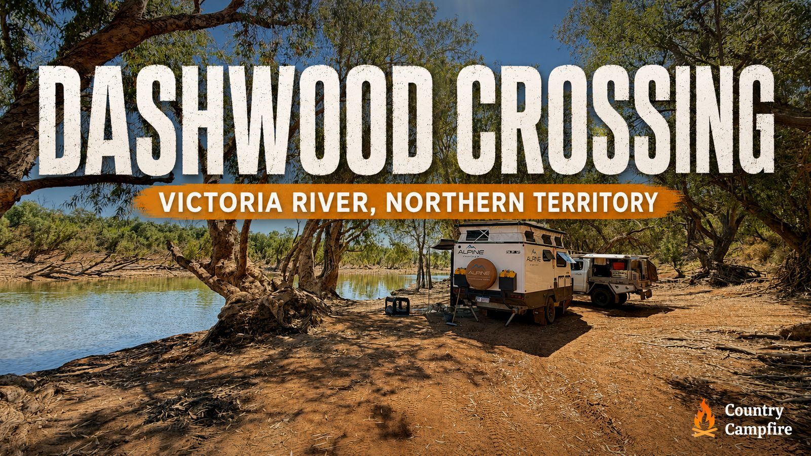
Dashwood Crossing is one of the latter: a quiet bush camp on the east bank of the Victoria River, approximately 85 kilometres west of Top Springs along the unsealed Buchanan Highway.
Gary and Christine Barten spent several nights here in August 2026 with their off-road caravan and two dogs. With mature paperbark trees, absolute river frontage and very little passing traffic, it offered exactly the remote riverside camping they enjoy.

Quick Campfire Notes
- Campground: Dashwood Crossing
- Location: Victoria River on the Buchanan Highway, west of Top Springs, Northern Territory
- Visited: August 2026
- Cost: Free
- Setup: Off-road caravan
- Travelling with: Couple with two dogs
- Best for: Self-sufficient travellers with a 4WD and an off-road caravan or camper
- Facilities: Basic bush camp with no facilities
- Campfires: Allowed when visited; check current restrictions
- Phone reception: Not confirmed; prepare for no service
- Access: Unsealed highway with corrugations, rocky sections and multiple river crossings
- Would they stay again? Absolutely
A quiet camp on the Victoria River
Dashwood Crossing sits directly beside the Victoria River. Gary described the east-bank camp as a fabulous spot with room for two vans and absolute river frontage.
Mature paperbark trees surround the campsite and provide generous shade. The river gives the camp its outlook, its fishing opportunities and much of its atmosphere, while the lack of traffic helps it retain the remote feel Gary and Christine value.
During their stay, only a handful of travellers or station vehicles passed on any given day. That quietness was one of the main reasons they enjoyed the camp as much as they did.
Fishing, cherabin and river country
The Victoria River offers the possibility of barramundi fishing, although the barra did not cooperate during this visit.
The cherabin were more obliging. Gary and Christine trapped a good number of nice-sized cherabin from the river, adding a memorable camp meal to their few nights beside the water.
Crocodile country
Like many northern Australian river systems, the Victoria River is crocodile country.
Gary said the water was fresh and running fairly clear over the crossing when they visited. They cooled off only in shallow water where they had good visibility, but he considered the deeper water strictly off limits.
Conditions can change and crocodiles can be present even when they are not visible. Treat the entire river environment with caution, follow current local advice and do not rely on another traveller’s experience as a guarantee of safety.
Getting to Dashwood Crossing
From Top Springs, travel west for approximately 85 kilometres along the Buchanan Highway. The campsite is on the east bank of the Victoria River, on the right-hand side when approaching from Top Springs.
Travellers approaching from Timber Creek should allow approximately 157 kilometres via the Buchanan Highway.
The location is listed in WikiCamps as Victoria River Ford, Dashwood Crossing.
Road and vehicle access
Gary recommends a 4WD and an off-road caravan or camper for the journey. The Buchanan Highway is unsealed and includes corrugations, rocky sections and numerous river crossings that can be hard on both vehicle and van.
Airing down to suitable off-road tyre pressures can help smooth out the ride. Road conditions can change with weather, traffic and maintenance, so check current information before committing to the drive.
Dashwood Crossing map and coordinates

Highway turn-off coordinates:
Get directions to the Dashwood Crossing turn-off
Download proper offline navigation before leaving phone coverage. These coordinates mark the highway turn-off beside the crossing, not every possible camping position.
Photos from Dashwood Crossing


Would They Stay Again?
Absolutely.
Gary and Christine really enjoyed their few nights at Dashwood Crossing. The shade, quiet surroundings, river frontage and lack of passing traffic made it the kind of remote camp they would happily return to.
A camp memory
The barramundi may have stayed hidden, but the river still provided. Gary and Christine’s successful cherabin catch became one of the memorable moments from their stay beside the Victoria River.
Thanks to Gary Barten

Gary & Christine Barten
Travellers • Campers • Campground Contributors
Gary and Christine Barten are Australian travellers whose love of remote camping, country towns and the road less travelled has helped showcase some of Australia’s hidden campground gems through The Campground Project.
Part of The Campground Project
This campground yarn is part of The Campground Project—Country Campfire’s effort to collect genuine campground stories, photographs and practical notes from people who have actually stayed there.
If you have found a campground worth sharing, you can submit your own campground yarn through The Campground Project form.
A quick note before you travel
Campground access, river levels, road conditions, fire restrictions, fees, dog rules and campsite availability can change. These notes are based on Gary’s August 2026 visit and are intended as a trip-planning reference only.
Always check current road and weather conditions, local advice, fire restrictions and relevant land-manager information before heading into remote country.